3-9 October 2011
From 3-7 October the first archaeological excavations at the Glory Hole site were carried out, followed by Open Days on 8-9 October. The British team worked closely with GEIOS (Groupe dŌĆÖIntervention et dŌĆÖEtude des Ouvrages Souterrains), French archaeologists and the Service D├®minage. Brian Todd from Bactec International,┬Ā specialists in explosive ordnance, EOD, bomb disposal and landmine clearance, was on hand at the start of the week to provide an ordnance awareness briefing.┬Ā Local people offered invaluable assistance.
Interpretation of the site
British and German trenches both within the site and beyond the boundaries towards the Lochnagar crater were marked out with flags, yellow indicating French and British positions, with red for the German front line. This exercise was invaluable in understanding the location of the site within the wider landscape of battle. Site aerials with trench lines overlaid can be viewed here: Aerial Photographs.

Red flags denote the German front line running near the Becourt road. Red posts with black boards mark the site of numerous shaft heads. Across
Linesman (a system of wartime trench maps tied to modern maps by means of a GPS interface) was employed to trace the original lines. The results were cross-referenced to coordinates from a 1915 aerial photograph overlaid upon images from Google Earth. An error of approximately five metres was discovered on the wartime British maps available on the Linesman system. This could be checked against existing known trenches still visible in the landscape.
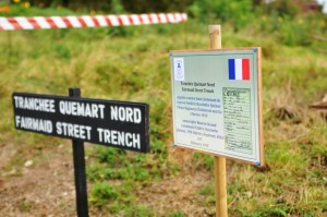
Trench board marking location of Tranch├®e Qu├®mart,named after Reserve Second Lieutenant Fr├®d├®ric Qu├®mar, 19th Infantry Regiment, killed 3 February 1915.
Front lines and trench names were marked with sign boards. Both the French and British trench names were given and in the case of the French names, the soldiers after whom the trenches were named. Some 21 French, British and German shaft heads were also marked. In addition, panels showing the locations of 38 French and British miners whose remains still lie in collapsed tunnels were placed on the surface directly above (or as close as possible) to their underground positions. If photographs of the men were available, these too were included on the panels. In the case of the French, casualty report forms were reproduced. As soon as archival studies are completed the same exercise will be carried out for the many German tunnellers who still lie beneath the site.
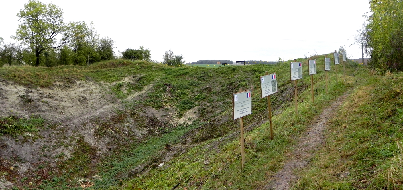
Signs mark the spot where eight French miners still lie underground, killed by a mine explosion on 7 February 1915.
┬ĀArchaeology
Archaeology was carried out by qualified French archaeologists under the direction of Anthony Byledbal and with the authorisation of the Directions R├®gionales des Affaires Culturelles (DRAC).
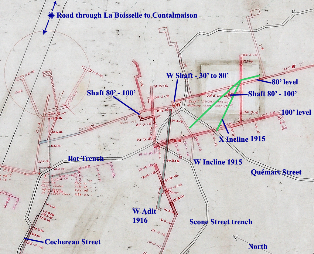
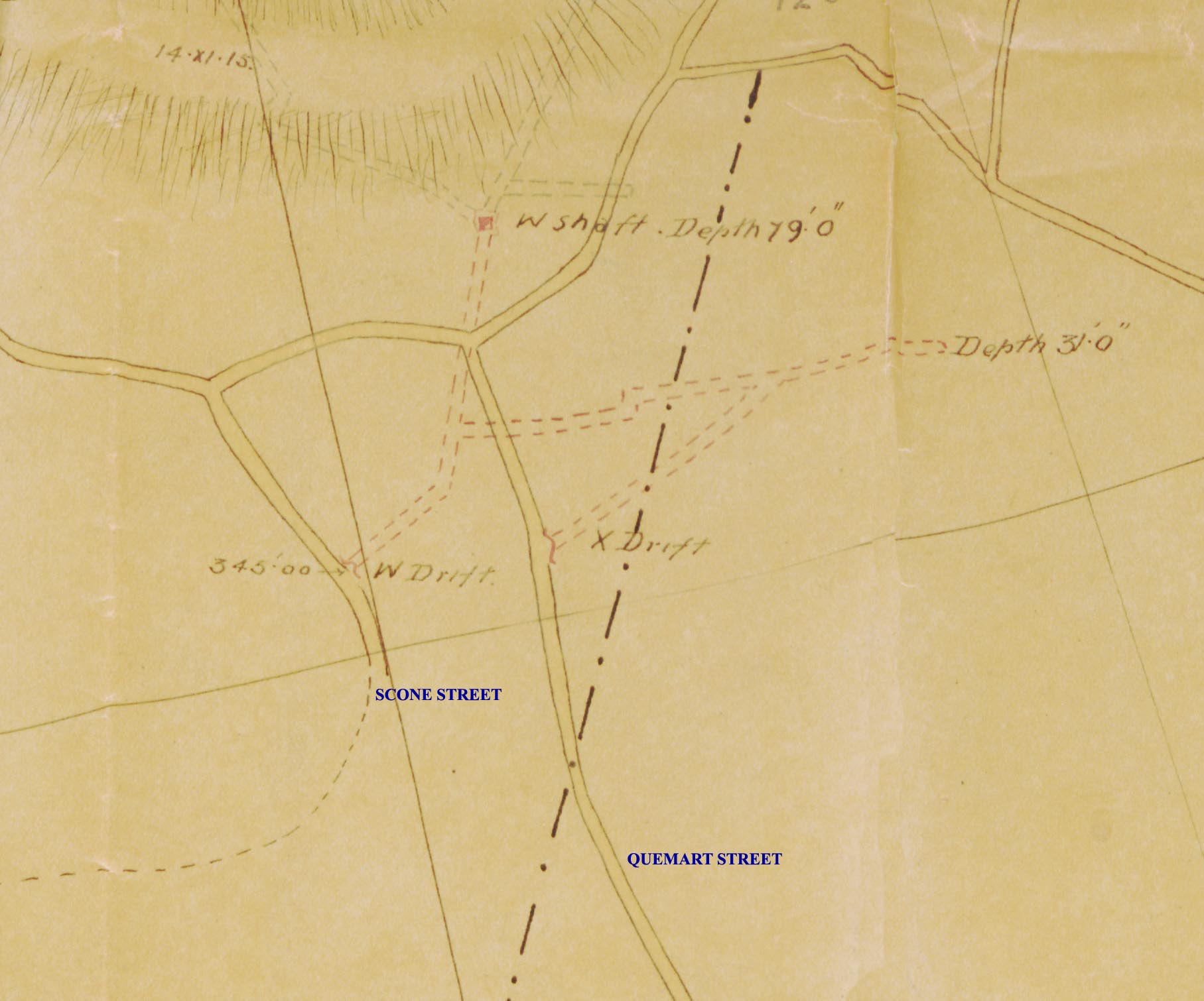
Extract from 179 Tunnelling Company RE Mining Map showing locations of the 1915 X and Y Inclines and the 1916 W Adit. Copyright National Archives, Ref: WO153/904 & reproduced with their permission.
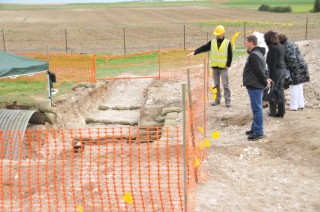
The archaeological objective for the week was to explore two mine entrances (X Incline and W Adit) and sections of their associated trenches. This was to establish their design and construction, an aspect that was either not recorded in British war diaries, or for which the relevant documents are missing or lost. It was hoped that a sondageto locate remnants of the Granathof farm buildings may have formed part of the study, but because it had proved impossible to organise the relevant geophysics (resistivity) prior to the excavations, this facet has been put on hold. Instead a section was cut through Qu├®mart Street trench, which in 1916 formed part of the British front line, to ascertain its depth and design.
X Incline
X Incline was one of five similar features which British records state were commenced in September 1915 immediately behind the front line, which at that time skirted the crater lips. This particular entrance originated in Qu├®mart Street, a communication trench originally constructed by French troops, which later became front line. The tunnellersŌĆÖ objective was to sink an entrance gallery to a depth whereby tunnels might be driven beneath the level of German workings which were approaching dangerously close to the British front line.
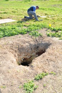
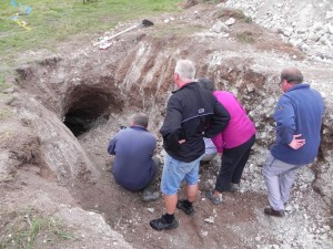
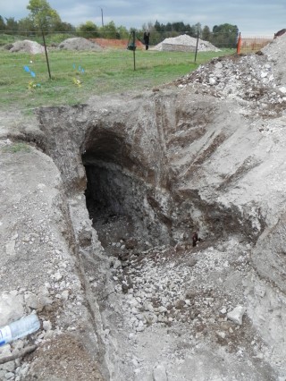
Our original entry into X Incline. Until archaeology commenced in October 2011 this collapse, from 2010, was the only way into the tunnel system. Staff Sergeant Steve Boylan RE can be seen preparing air pipe for use underground.
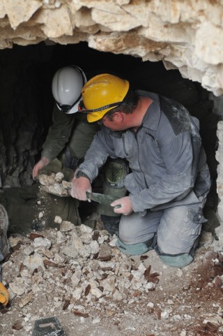
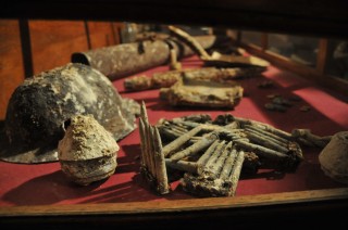
It proved impossible to locate the junction of the incline and Qu├®mart Street as a result of the archaeologists uncovering a mass of materiel in the tunnel entrance consisting of rum jars, jam and condensed milk tins, Maconochie and bully beef tins (British), bottles (French and British), pickle jars, bullets, and some more personal items such as a silver-plated hip flask. In addition large quantities of well-preserved and hazardous barbed wire fragments, apparently French, and an original iron picket were also found here. The careful extraction of the artefacts meant that progress was slowed; the remaining few metres of tunnel/covered trench connecting to Qu├®mart will be completed next spring. The area above the shallow ŌĆśthroatŌĆÖ of the gallery close to where it joins the trench had apparently collapsed. It may in fact not have had solid earth head cover but some other form of splinter-proof protection such as elephant shelter sections or heavy timbers. Once this protection decayed or was removed, the surrounding geology would have readily caved in and filled the gallery.
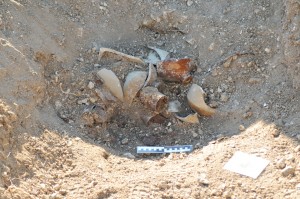
Trench materiel from the tunnel entrance included rum jars, jam and condensed milk tins and Maconochie and bully beef tins.
The large artefact collection found here may have been rubbish produced and discarded by the occupants of Qu├®mart Street, or detritus collected and dumped by land clearers in the post-war period. The area was eventually cleared by the archaeologists, revealing much of the collapsed gallery entrance beneath. Vertical timber supports (legs) were still in evidence but in a severely decayed state. The original floor level of the shallow gradient leading to the steeper 40-degree main slope of X Incline had been created by a series of sandbag steps.
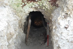
X Incline after opening and clearing. Vertical timber supports are still in evidence, but in a severely decayed state.
These, studied alongside the narrow and low gallery dimensions, showed that spoil was being carried from the workings by hand rather than with trolley run on rails. At the point where the gallery begins its steeper descent the dimensions of the timber support frame (known as a sett) were 0.84m wide at the base (the sole), 1.12m high (legs), and 0.45m wide at the roof (cap). British tunnellers did not work on X Incline for long. Although the workings were abandoned in favour of W Adit, the galleries were kept open as alternative escape routes.┬Ā Some of the workforce were employed in the sinking of 50-foot vertical shafts from chambers at the 30-foot level. Because French records also note the existence of a feature annotated as ŌĆśXŌĆÖ, research is underway into the precise origin of this incline.
W Adit
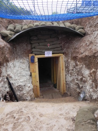
W Adit was driven in March 1916 to create improved access to W Shaft. It greatly facilitated removal of spoil from the shaft which itself enhanced access to the 80 foot mine system. By the sinking of further shafts this level was extended to a depth of 100 feet (30 metres), so vast quantities of spoil would have had to have been removed via the W Shaft route. The water table was reached at just over 100 feet.
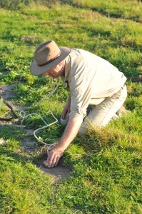
Peter Barton using a geophone to plot the location of W Adit. Team members two metres beneath him in W Adit tapped on each gallery wall, the sound being located and plotted on the surface.
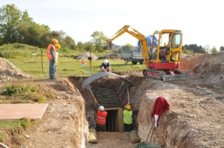
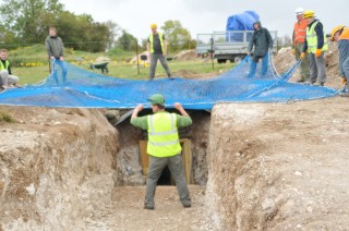
In order to reopen W Adit its location first had to be identified on the surface. This was done by using a Geophone, the original device developed in 1915 for underground warfare. Team members inside the gallery, i.e. underground, were in contact with their surface colleagues by field telephone. They were requested to tap on each gallery wall respectively, and the sound was located by Geophone and plotted on the surface by stones.┬Ā Despite a complete lack of experience by the operator, the method proved highly effective, producing an error of only 40 centimetres. The gallery was quickly found. Its upper section was found to have collapsed along a length of approximately seven metres from where it originated in Scone Street, a British communication trench. This failure too may have been as a result of the removal of timber or steel splinter-proof protection. The remnants of heavy upright timbers were found, indicating that some form of cover is likely to have been present. It is certain that large amounts of earth was piled on top of this most vulnerable part of the Adit to form deflection and burster courses against the effects of shell and mortar fire.
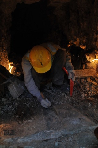
The gallery of W Adit was considerably more roomy than X Incline, being 1.80m high and 1.45m wide. The slope was much more gradual than X Incline. In the centre of the gallery there were clear vestiges of the tramway that had been fitted to facilitate the extraction of chalk spoil produced by the driving of the 80 and 100 feet systems and their associated features. The tramway was of a typical sleeper and rail pattern and appeared to have been fitted with wooden rails. As well as spoil removal it would have been used to carry timber down to the shaft head – and of course explosives for the many charges blown underground during the period of active mine warfare. The archaeology of the original floor of W Adit will be completed during the winter of 2011-2012.
W Shaft
The opening of the W Adit was required not only to provide safe access to W Shaft chamber but also to produce circulation of fresh air through the galleries connecting the two entrances. Opening both entrances created a natural flow, with X Incline forming the downcast feed and W Adit the upcast vent.
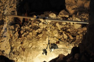
A Go-Pro HD camera ready for its descent down the 50 foot W Shaft. Footage showed the shaft to be in an excellent state of preservation along its entire visible depth.
With access and ventilation thus improved, a Go-Pro HD camera was lowered down the 50-foot shaft in order to ascertain the structural integrity of the square cut unsupported chalk walls (approximately 1.5m square) and conditions at the foot.┬Ā The images revealed that the shaft was in an excellent state of preservation along its entire visible depth. At the base, debris fallen from the area around the shaft collar and the roof of the chamber appears to have reached a depth of 3-4 feet, blocking access the two galleries that emanate in roughly east and west directions at the 80-foot level at the foot of the shaft.
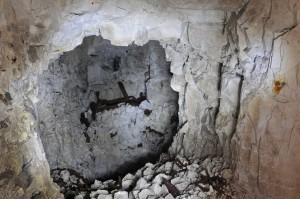
W Shaft chamber. The entire area needs clearance, making safe and archaeology before a descent to the lower level can be attempted.
The next phase of work underground will be preparations to descend the shaft. This will begin with the complex task of roof support in conjunction with debris clearance and archaeology along the entire length of the Adit and within the shaft chamber itself. Only after these areas have been made safe will a descent of the shaft be attempted. In the meantime research in British, French and German archives will continue in parallel with the archaeology of the incline and Adit.
The Granathof
Excavations to locate the remnants of the Granathof, the farm originally located on the site, are not yet underway as we await the resistivity survey.┬Ā Today, save for many bricks in and around the craters, no trace of the farm survives above ground. 2012 will hopefully produce the geophysics results which may indicate whether vestiges of the farm still exist. If so, there will be one or more sondages to investigate this most symbolic of sites for the Breton troops who held the sector until handing over to the Black Watch in August 1915.
Open Days
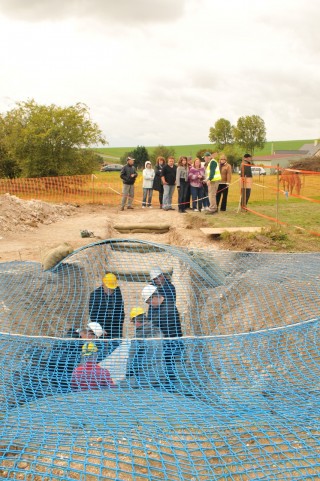
Although the site was open to all during the excavation phase, special open days were held on 8th and 9th October. As well as dedicated tours on the surface, the excellent state of the W Incline allowed the Group to take small groups of five visitors at a time safely underground as far as the W Shaft chamber.
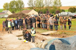
Visitors queue to enter W Incline in small groups. They were taken to W Shaft Chamber – at a depth of 10 metres underground.
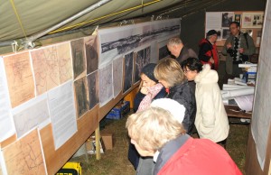
The support and knowledge of local communities is vital to the project, so the portes ouverteson Saturday 8th was dedicated to the people of La Boisselle and the wider Albert region. In a large military tent an exhibition was created with maps, plans, panoramas, photographs and artefacts. Fortuitously, a large group of visitors from Brittany were in the area for the rededication of the refurbished memorial at Ovillers to the French (Breton) 19th Infantry Regiment, who held the trenches at the site until July 1915. Family members were for the first time able to visit the site where their antecedents had served.
Other visitors included distinguished French archaeologists including Alain Jacques and Yves D├®sfoss├®s, representatives of the Commonwealth War Graves Commission, personnel from the DRAC and the Conseil G├®n├®rale, and M. Jean-Marc Bassaget, Sous-Pr├®fet of P├®ronne. The Group was especially pleased to welcome the descendants of two British tunnellers who served at La Boisselle, one of whom died underground and is buried at nearby B├®court. In the evening at a special vin dŌĆÖhonneur the Group took the opportunity to thank the many organisations and individuals that have assisted and facilitated work on the project so far. These included the Lejeune family (the proprietors of the land), Mme. Line Wattraint, Maire of Ovillers-La Boisselle and her Adjoints (and family), M. St├®phane Brunel (Conseiller G├®n├®ral of Albert county), the Conseil G├®n├®rale of the Somme, the DRAC and CIRAS, the Historial de la Grande Guerre, P├®ronne, the Securit├® Civile and the Service D├®minage, the Delporte and Villain families, and the numerous local people who had made the first stage of the project so rewarding and pleasurable. Toasts were drunk with French champagne, English Chapel Down sparkling wine, and with William Hackett Ale, a beer specially brewed for the occasion by Barngates Brewery in the English Lake District. William Hackett of Mexborough, Yorkshire, is the only tunneller in history to be awarded the Victoria Cross. Sunday 9thwas a day for the general public and the Group were delighted to welcome many visitors from the UK, Germany, the Netherlands, Belgium, Canada, USA, Australia and New Zealand.
Selected images
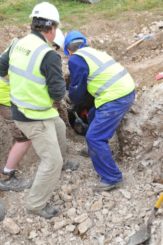
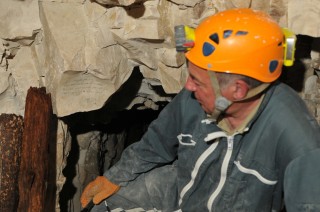
Jeremy Banning is helped out of W Incline by historian Simon Jones – the first person to emerge from the tunnel for over 90 years.
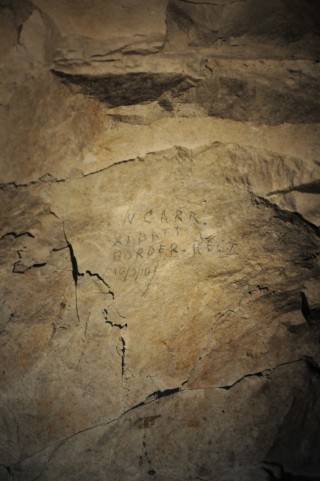
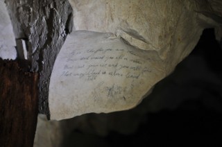
The name of William Carr, dated 16 March 1916 on the wall in W Shaft Chamber. William Carr was serving in the 11th (Lonsdale) Battalion, Border Regiment in March 1916. He was killed in June 1917 whilst serving with the 2nd Battalion and is buried in Grevillers British Cemetery near Bapaume.
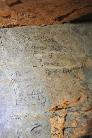
More graffiti in X Incline from 11th Border Regiment men. Two of the names are those of Obadiah Henderson and William Chard.
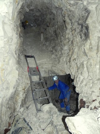
View from W Shaft chamber. The tunnel from X Incline joins from the left whilst W Adit, driven in March 1916, is running to right.
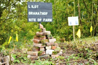
Sign boards and a temporary memorial cairn mark the site of the Granathof. It is built with bricks from the original farm found in the craters.
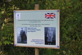
Sign marking the spot where Sappers John Lane & Ezekiel Parkes still lie entombed at a depth of 24 metres following a mine explosion on 22 November 1915.
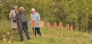
Visitors pay their respects at the spot where eight French miners, killed on 7 February 1915, still lie entombed.
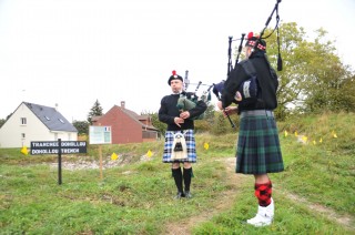
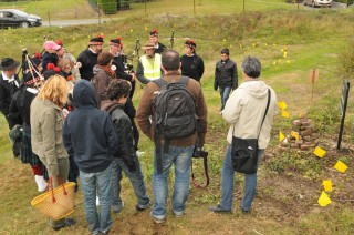
Bretons piping at Tranch├®e Dohollou, named after Second Lieutenant Jean Dohollou, 19th Infantry Regiment, killed 3rd March 1915.


34 Responses to Archaeological dig reports